Wind, waves, weather during data collection at OHGR/Dartmouth
 | Data collection times
| Wind direction
| Wind speed
| Wave height
| Wave period
| Data collection times
| Wind direction
| Wind speed
| Wave height
| Wave period
Temperature | Humidity | Rainfall | Wave direction
Wind, waves, weather during data collection at OHGR/Dartmouth
| Data collection times
| Wind direction
| Wind speed
| Wave height
| Wave period
Temperature | Humidity | Rainfall | Wave direction |
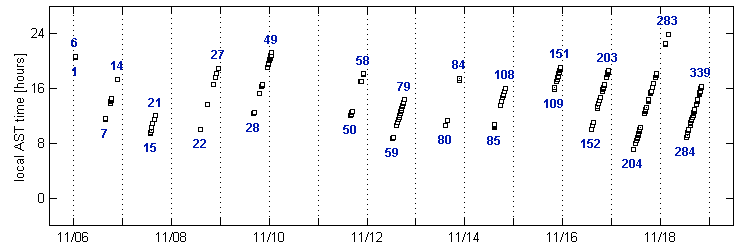
| November 1993 data collection times |
|---|
|
| UTC date [MM/DD] |
|
Blue numbers: indices of the first and last dataset collected on each experiment day; Black squares: datasets. Date (X-axis) is in UTC coordinates, 4 hours later than the local AST time (Y-axis). |
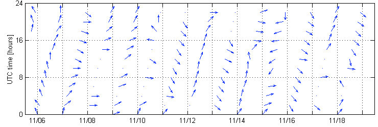
| Wind direction |
|---|
|
| UTC date [MM/DD] |
|
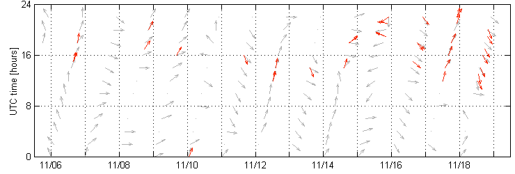
Blue arrows: wind direction, interpolated from raw data to get 2-hour spaced vectors. Date (X-axis) and Time (Y-axis) in UTC coordinates. |
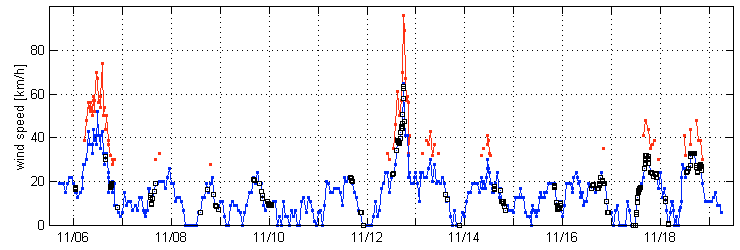
| Wind speed |
|---|
|
| UTC date [MM/DD] |
|
Blue: wind speed [km/h]; Red: wind gust speed [km/h], only recorded when gusts are significant; Black squares: wind speed [km/h], interpolated at data collection times. |
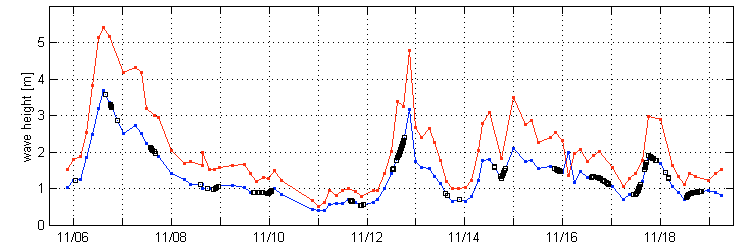
| Wave height |
|---|
|
| UTC date [MM/DD] |
|
Blue: significant wave height [m] over 3 hour interval; Red: maximum wave height [m] over 3 hour interval; Black squares: significant wave height [m], interpolated at data collection times. Note error just past 11/16 (max. height<significant height). Data may contain more typos. |
| Wave period |
|---|
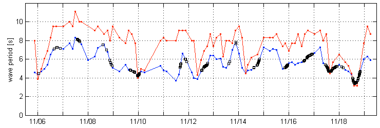
|
| UTC date [MM/DD] |
|
Blue: average wave period [s] over 3 hour interval; Red: dominant (peak) wave period [s] over 3 hour interval; Black squares: average wave period [s], interpolated at data collection times. |
| Temperature |
|---|
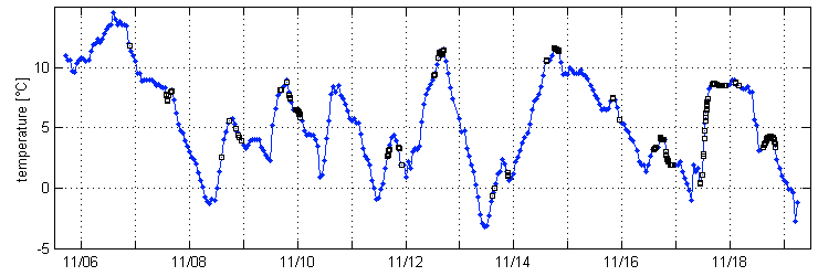
|
| UTC date [MM/DD] |
|
Blue: temperature [°C]; Black squares: temperature [°C], interpolated at data collection times. |
| Rel. humidity |
|---|
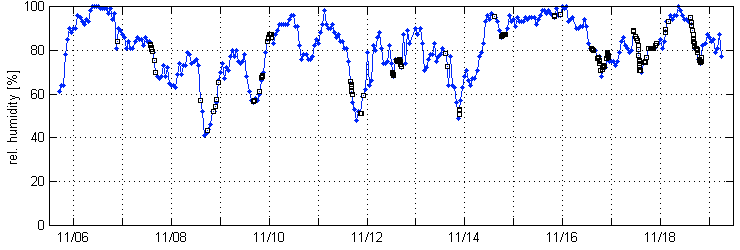
|
| UTC date [MM/DD] |
|
Blue: rel. humidity [%]; Black squares: rel. humidity [%], interpolated at data collection times. |
| Precipitation |
|---|
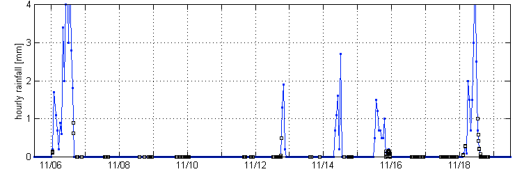
|
| UTC date [MM/DD] |
|
Blue: hourly rainfall [mm]; Black squares: hourly rainfall [mm], interpolated at data collection times. |
| Wave Direction |
|---|
|
| UTC date [MM/DD] |
|
Red arrows: wave azimuth, as computed with Doppler Sine Wave method Gray arrows: wind direction (copied from wind direction plot). |